Explore & save
Search a place, filter the view, and save records you want to revisit in Saved Cameras.
Flock Around. Find Out.
Explore community-mapped camera locations, understand the record behind a marker, and compare the map around a place or along a trip.

Community coverage may be incomplete.
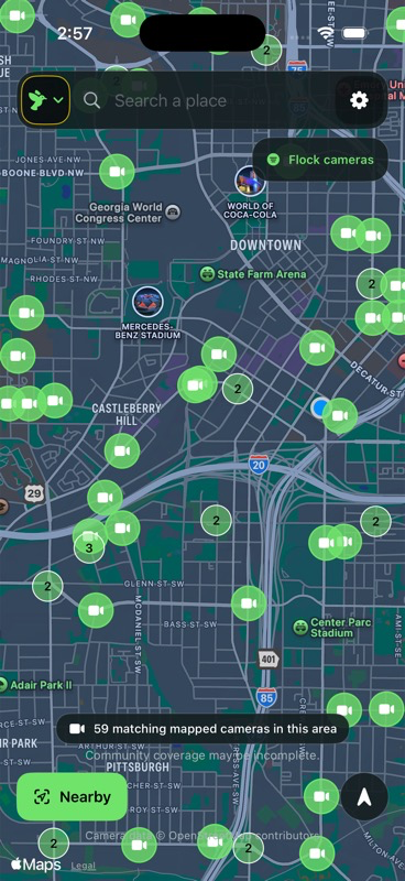
Included, free
The map, Cameras Near Me, and Cameras Along Route are free to use. Optional one-time supporter purchases change the app icon without unlocking extra camera tools.
Search a place, filter the view, and save records you want to revisit in Saved Cameras.
See mapped records near you or compare available routes. Directions come from Apple Maps; route comparison does not provide navigation.
Keep reported fields separate from derived location context. Open the original source record when one is available.
Inside Flock AFO
Explore the map, choose a marker, compare routes, and check the record.
Search a place, filter to Flock cameras, and explore the mapped records.
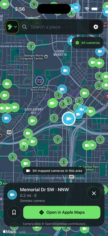
Keep the map in view while you inspect a marker and its location context.
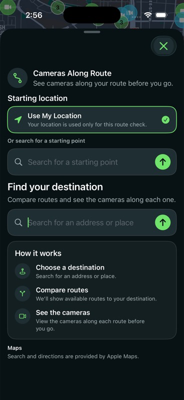
Choose a start and destination, then compare available routes and nearby records.
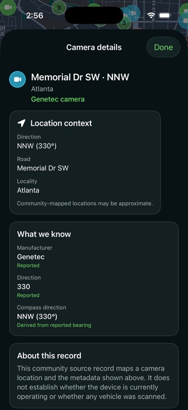
See reported fields and derived context separately, with a source link when available.
How it works
Use the map to inspect what is available and decide which details are useful to you.
Start with a place search, browse the community records, and choose a marker. Keep the surrounding map in view as you inspect a record or open its location in Apple Maps.
Check reported details such as manufacturer and direction alongside derived map context. Follow the source when available, and save useful records for another look.
Choose a starting point and destination in Cameras Along Route. Compare available Apple Maps routes and the community-mapped records near each one.
Know the limits
Mapped records can be incomplete or out of date. A record does not establish that a camera is active or scanning.
Flock AFO helps you inspect what is available, rather than filling in the gaps.
Read about privacy and data handlingData source and acknowledgment
Flock AFO uses public camera-location data made available through FlockHopper’s deflock-data project. The data derives from OpenStreetMap; thank you to FlockHopper and OpenStreetMap contributors.
Camera records and coverage may be incomplete or out of date. Mapped data is available under the ODbL 1.0 license.